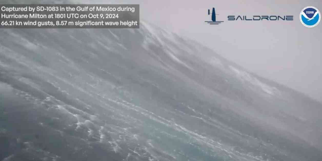
An unmanned ocean drone known as a Saildrone captured a massive 28-foot-high wave as Hurricane Milton passed through the Gulf of Mexico. The video of the wave crashing down was recorded 40 nautical miles from the center of the hurricane with wind gusts reaching up to 75.98 mph. Saildrone plays a crucial role in providing ocean mapping and data to the National Oceanic and Atmospheric Administration (NOAA).
The footage from the drone highlighted the powerful impact of the storm at sea before it made landfall in western Florida. The NOAA described this research as a collaborative effort to gain a better understanding of the ocean’s role in hurricanes. The data collected from Hurricane Milton aids in forecasting the path and intensity of such storms.
In addition to the ocean drone, the NOAA also conducted flight missions using the Aircraft Operations Center’s WP-3D Orion #NOAA43 plane, nicknamed “Miss Piggy,” to gather data from within the eye of the storm. Scientists aboard the aircraft measured various parameters like pressure, humidity, temperature, wind direction, and speed to analyze the storm’s structure and intensity.
Hurricane Milton unleashed its deadly force across Florida, causing widespread destruction and leaving millions without power. Despite the devastation, Florida Governor Ron DeSantis noted that the storm, while significant, did not result in the worst-case scenario. The hurricane spawned multiple tornadoes in southern Florida, leading to the tragic loss of lives in St. Lucie County.
Search and rescue operations were promptly initiated in the aftermath of the tornadoes, with first responders working tirelessly to locate and assist victims in affected areas. The state mobilized around 10,000 National Guard members, with additional support coming from neighboring states to aid in the recovery efforts.
The catastrophic events caused by Hurricane Milton serve as a stark reminder of the destructive power of nature and the importance of advanced monitoring and research techniques in preparing for such disasters. The collaboration between agencies like the NOAA and the deployment of innovative technologies like ocean drones play a crucial role in enhancing our understanding of these extreme weather events and mitigating their impact on vulnerable communities.


